HowTo:

Use AFTrack for Sailing


AFTrack is available in 3 versions - all are usable for sailing:

Settings

There are some useful settings for sailors

Units
will be found in GPS settings,
wind speed units in Display settings
GPS Mode
GPS data can come from different devices. For online and bluetooth an extra definition is needed.
Online GPS comes over TCP, UDP or as a Signal K websocket. For websocket it is possible to define an address like an ip
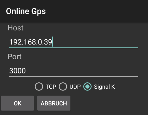
Online settings

When the incoming GPS signals are not satisfying, it is possible to work in a mixed mode. The position messages from an external device are ignored than and for position the internal GPS is used.
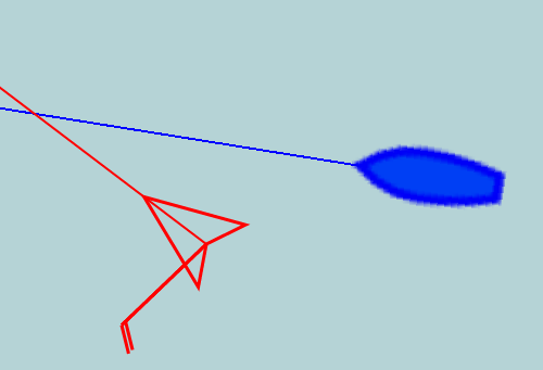
GPS Mixed Mode
Collect NMEA data from external services (Bluetooth, Wifi, USB) but use the internal gps for prosition
Wind IndicatorWind indicator on position
Display settings, shows a wind arrow with feathers
10 Minutes Distance
Display settings, show an arrow from position to the probable position in 10 minutes,
if AIS entries on display they also have an arrow.
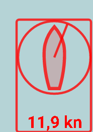
Wind Info
Wind Info on Map
Display settings, shows a wind information on map

With a tap on the wind info a pop up shows the wind settings
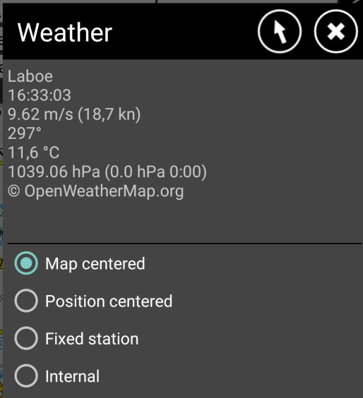
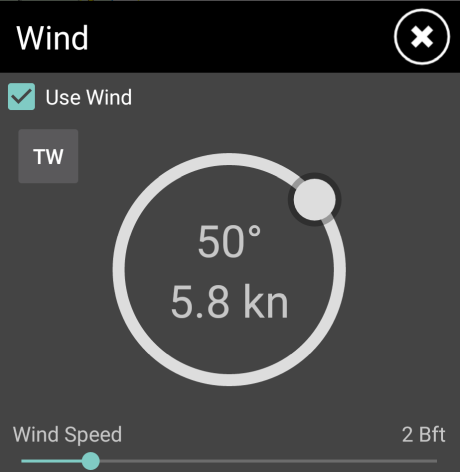
Wind Settings
When not internal is selected, the info shows the weather values of the nearest station to the map center. This is updated every 5 minutes.
Other options show different results.

For use of an internal wind feature, please select this and press the arrow to define a wind direction and speed by hand.
Wind definition by hand
When there is no input for an external wind instrument this values are used.

Wind Routing
Display settings, enable the use of wind informations for the GoTo or routing mode
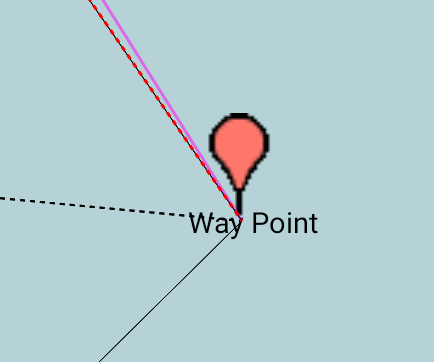
Layline Way point
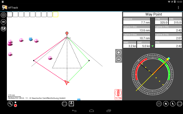
Layline on a way point
Display settings, shows the laylines of the way point in GoTo mode
Boat

Display settings, defines best angle to wind and max speed
This values are used for wind routing calculation when no polar values available.
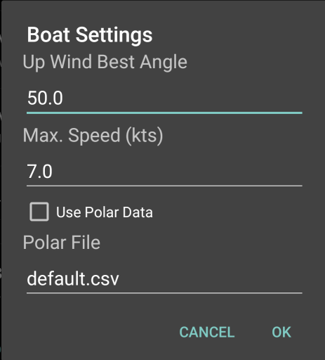
Boat settings

When polar values from a file should be used check the box. The files should be stored in AFTrack folder /data/aftrack/polar like the default.csv CSV files are converted to a xml file and also placed in polar folder.
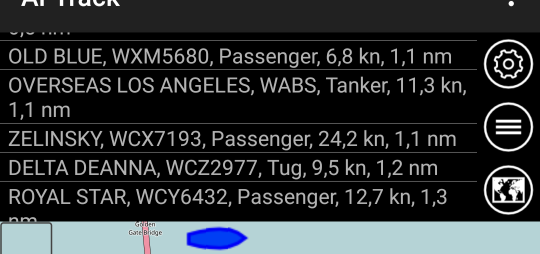
AIS Dock
Display settings, replaces the profile dock view with an AIS list

AIS Dock
AIS small icons Show the AIS symbols in smaller layout and scale it when possible

AIS icons
AIS track
Show a path for a ship or for all ships

AIS track
AIS group
Show a group of ships in a seperate color. Please define a file with name 'aisgroup.txt' and place this into the AFTrack folder 'conf'.
The file contains a MMSI on each line.
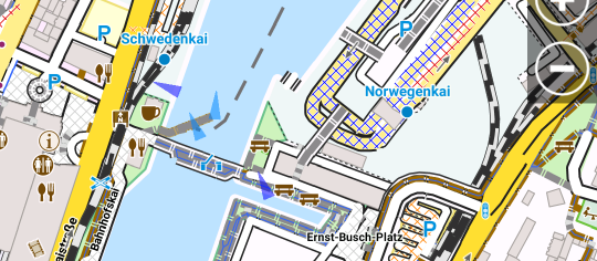
AIS group
Anchor Alarm Overlay Select the overlay button and set the alarm
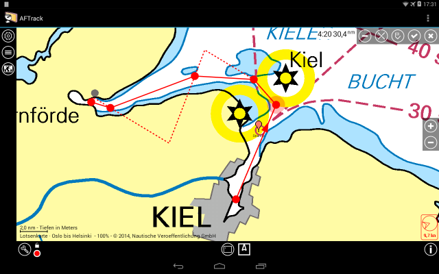
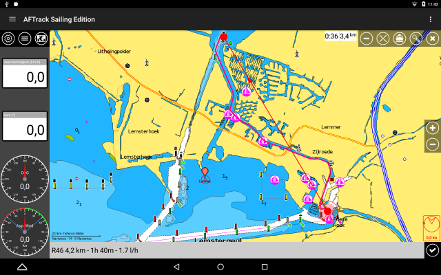
For some clearing have a look to Wikipedia for Tacking or Jibe.

Nautical Charts


Main used chart format in AFTrack is the BSB format. You will find some sources here.

You may also use the NV-digital charts (this is encrypted BSB3 format).

The new NV-digital tiled format is also available, please do a map scan, when installed.

Use Navionics Charts

There are several other map formats for AFTrack: sqlite, mbtiles, mapsforge, osz, mph/mpr or jpg, png, bmp, tiff with calibration file


Planning a Trip

It is recommended to switch off the GPS first to get a clear planning of a trip. Work with fixed values for wind and speed. Set the wind direction and speed via the wind info dialog. Set the boat speed according to the expected wind in the display settings for wind (Not necessary when using polar data).
Press a point on the map for a longer time and select the ruler for a route design. Add some points when needed.

Routing with wind

The distance is not only calculated from the point to point distance. It also contains the laylines from point to point when next point is not reachable in a direct way.This is an idealistic way of view to the route. The boat has to do some more tacks then the display shows.
Please keep in mind, we are not calculating current, drift, wave or cost of maneuvers.

Waterway Routing

Another way of plannig is the routing not with the wind angles but with the canals and rivers around. AFTrack works with BRouter app.

Routing with brouter on waterways

Please see this waterway rounting page for more information. You will also find ideas of future routing versions. It will calculate brigde and loc times.

On the Water

Use the wind instrument for an orientation.

  
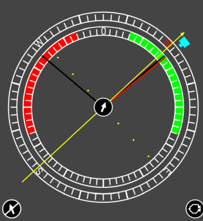
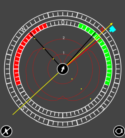
Wind instrument Wind intrument with polar
with boat parameter
with polar values


The outer ring shows the boat direction and has the true wind in cyan and a blue area for the one hour wind average with cyan center and the direction of change on one end.And an arrow to the selected way point.

The inner circle shows the relative wind situation with the best tack angles (from settings or from the polar values). Also a four minutes average of the true wind relative to the boat which helps to assess teh situation.

The view is in GoTo mode. It can switched of by pressing the GoTo button.

To stop the GoTo mode with sail routing press the motor button. GoTo mode calculates now for the direct way.

In the middle is a wind buttom shown. This is only visible when the wind values are manuell done. It can be used to adjust the wind direction. This makes only sence when the defined wind angle for your boat is nearly correct and you are sailing on best way to wind.

Please keep in mind, the four minutes wind average can be better than the best tack angle because there are influences by waves and current. Before you edit the boat parameter for that please have a look on the opposite site if there is the same deviation.

On a Trip you tap a way point and select the arrow button. This starts the GoTo mode.
Like this

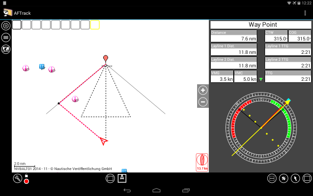
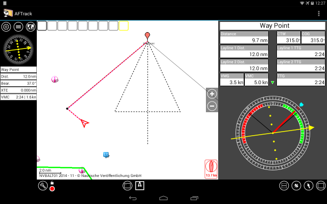
GoTo mode with wind
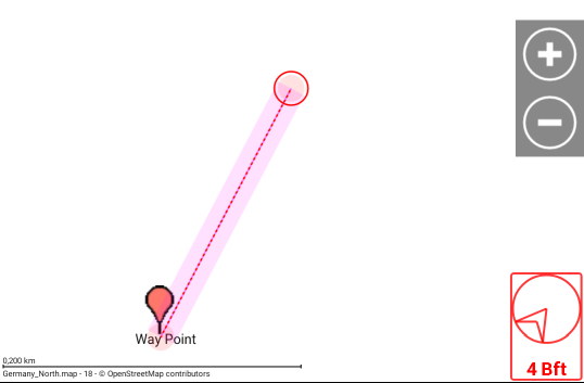
The route at GoTo mode start is displayed in magenta.
All other values are recalculated continuously. Notice the 10 minutes position and the laylines of the way point.


Please keep in mind this is an idealistic view. Newer go direct to the laylines accept the last half mile.
It is better to stay in the green area not to get in trouble when wind direction changes.

A better way using laylines


Standard situations during sailing


Wind from direction of way point. Both legs are equal and there is no favorite side.

course to way point sample 1


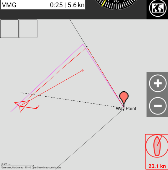
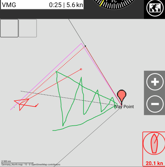
The Wind again comes from way point direction but way point isn't in direct position. The course line is shown like this because ship is going this direction.
But it's recommended to tack to come into the favorite area (dotted lines) in the middle of tack angle to protect you for wind shifting.


Another problem is the current. AFTrack trys to calculate it from course over ground and course through the water.
In this case an extra line is shown (green line, this means not a star board line, it' only an opposite line).
Again it's recommended to tack as you see on the side. Layline 2 is shorter and will bring you to target ealier.
The green line ist shown when the gap of both distances are greater than 100 m - tack will cost you a little bit.


Corridor Routing


To help you with the correct cross track error (XTE) you could avtivate the corridor routing.
Set the Display Settings

Corridor Routing: on
Single Alarm: on
Route Alarm Distance: as you like, in meter

Wind Info: on
Wind Routing: on
Layline Wpt: on

Check also the boat parameters if it will work for your boat.

When wind is not running, you may set the 'internal' wind by tapping the wind gauge. E.g. simulation at home.

Select a way point and press the got button (arrow)
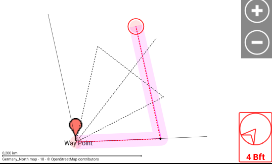
You will have one of the situations in the pictures. Belongs to the wind direction.


Go direct

:

You will have an alarm when you leave the corridor. This is switched off when you are back inside the corridor, or when you select the 'stop' from the notification in the system status line. In this dialog you also can select 'reset' to define a new starting point.
The alarm is also send to a bluetooth watch.

go against the wind:


This is different, you go to the first leg, but you will get an alarm on changing towards the way point. So after the round it is a good idea to do a reset when course becomes stable.

The displayed way is an idealistic one. I would newer go over the whole leg, I would go round between the dotted line and the layline, not to run in trouble with changing winds.

When in sailing routing and in the goto view of the app you will find an engine button. You could switch the motor on (when you NMEA doesn't contain sentences about this) and the goto mode is resetted to direct go to the way point.

Planning a Regatta

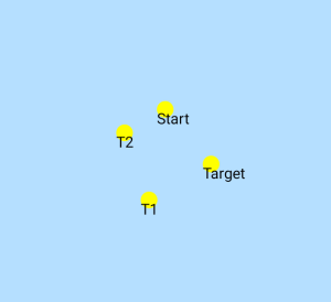
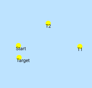
AFTrack  has a feature which could be useful for regatta planning: Insert a way point selection.
You have to activate this feature before using.
And you need a definition file with the name wptcollection.txt. A sample is found in AFTrack folder conf. Build something like this:

# first line wpt group name, icon
# all other are wpt: name, icon
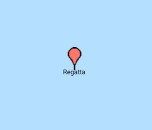
Regatta;pointer1.png
Start;ton.png
Target;ton.png
T1;ton.png
T2;ton.png

And copy new icons to the AFTrack icon folder.

When it is activated you have a new entry when you do a long press on the map

way point collection

After pressing the third button a new way point group is added and you have the collection icon on the map.

Regatta collection

When you tap on this icon all related icons are shown around the collection point.

Regatta all tons

Move the points to its favorite places and send the waypoint group to the participants by export.
Set the  property of the group from 'As Collection' to 'Visible' to see all  points on the map.

Regatta collection


Use extra hardware


Build your own GPSD on a Raspberry Pi
Use the OpenSeaMap logger project
Or get ready to use hardware from vYacht, iKommunicateSailTimer Mini-Server
Best results reported with NMEA to WiFi interface from Comar Systems
Or use SEANEXX AIS-Receiver (USB direct or with wifi module)

Use a wireless Anemometer


To handle external devices with special specification AFTrack uses plugins, see here for more information
One of these is for the SailTimer Wind Instrument™, an autonomous and cableless mast head unit using Bluetooth Low Energy for transfer

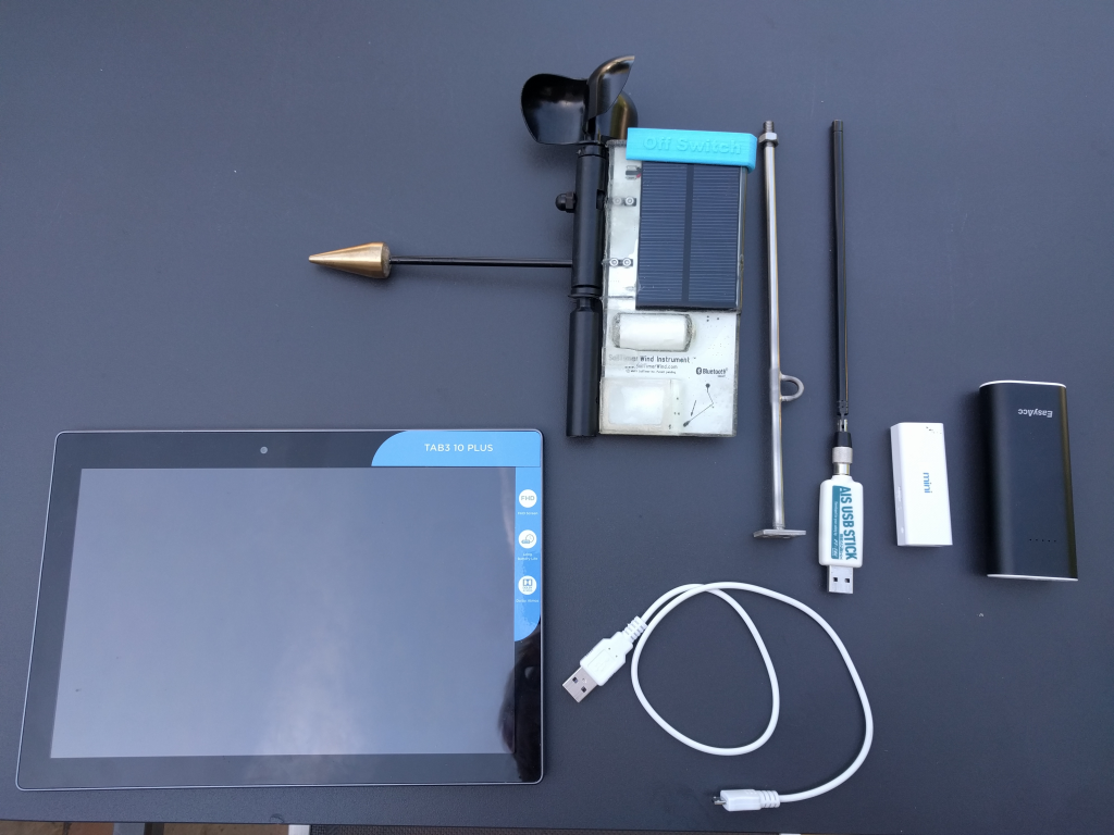
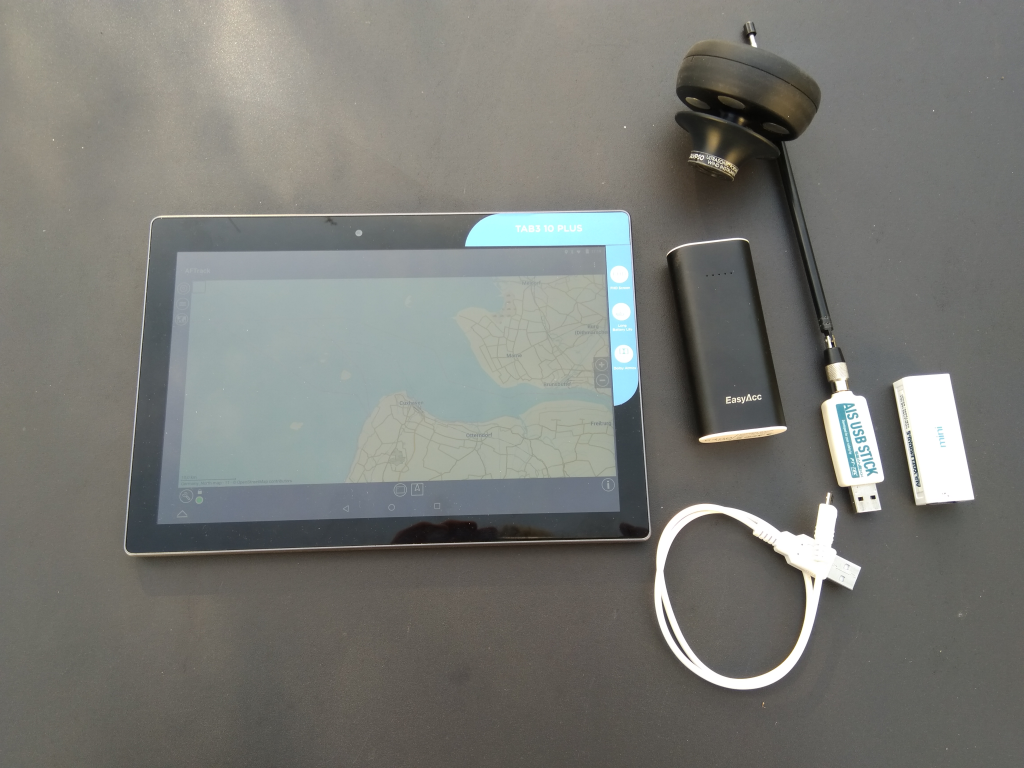
My travelling samples for independent sailing (usable with hand luggage):
Wind instrument (from SailTimer™ or Calypso), AIS USB stick, wifi router, power bank and AFTrack on a tablet

SailTimer Wind Instrument Calypso Wind Instrument